
Walk a Blue Island Street
A sound Blue Island street directory search separates ownership, mailing, and occupancy. Begin with the address as written, but expect each official system to format it differently. USPS can check delivery wording. CookViewer can locate the parcel and its 14-digit Property Index Number, or PIN. The Assessor identifies the parcel location and owner record, while the Cook County Clerk recording index follows deeds and other recorded instruments. Voter information and dated directories can add evidence about a person, but neither should be stretched beyond its date and stated purpose.
This sequence keeps a street search tied to records that can be checked. It also helps when one portal fails, because the PIN found on a parcel map can become the search key in the next system.
- Check the delivery form in USPS when the city, suffix, or ZIP is uncertain.
- Open the address in CookViewer and save the parcel outline and PIN.
- Compare the Assessor location with the Treasurer's tax-bill mailing field.
- Search the Cook County Clerk recording index by PIN, address, grantor, or grantee.
- Use a voter lookup only within its legal limits, then consult dated criss-cross directories for a historical household lead.
The result is a chain of dated facts, not a claim that every person named still lives there. For the older shelf material itself, consult the Blue Island city directory collections.
Search Blue Island Address Fields
The Cook County Assessor advanced search is the strongest way to scan a range of house numbers along one Blue Island street. Its address branch accepts a starting and ending house number, unit range, direction, street name, city, township, and property class. The ordinary address search has a vital quirk: enter the street name without Avenue, Street, or Drive. A CAPTCHA must also be completed.
| Search field | How to use it | Limit |
|---|---|---|
| House Start / End | Set one number or an address range | Does not prove occupancy |
| Direction | Select the compass prefix when present | Options can change |
| Street Name | Use the name without its suffix | Historic names need conversion |
| City / Township | Narrow the county search to Blue Island context | Postal and municipal labels can differ |
| PIN range | Search eight or more leading PIN digits | Splits can create new PINs |
The captured Assessor search screen shows those branches and controls.
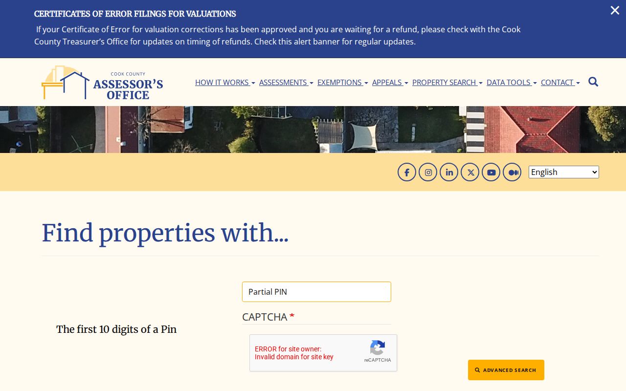
That screen makes the range search more useful than guessing owner names one parcel at a time.
Map Blue Island Parcels
CookViewer accepts a PIN, address, or intersection and displays the parcel outline. Property Details can then expose the key needed for Assessor and recording searches. The map also supports nearby parcel inspection, layer viewing, print, and export. It is well suited to a whole block because the user can see adjoining geometry instead of assuming where one tax parcel ends.
The CookViewer capture shows the address, intersection, and parcel-search controls used in a Blue Island street lookup.
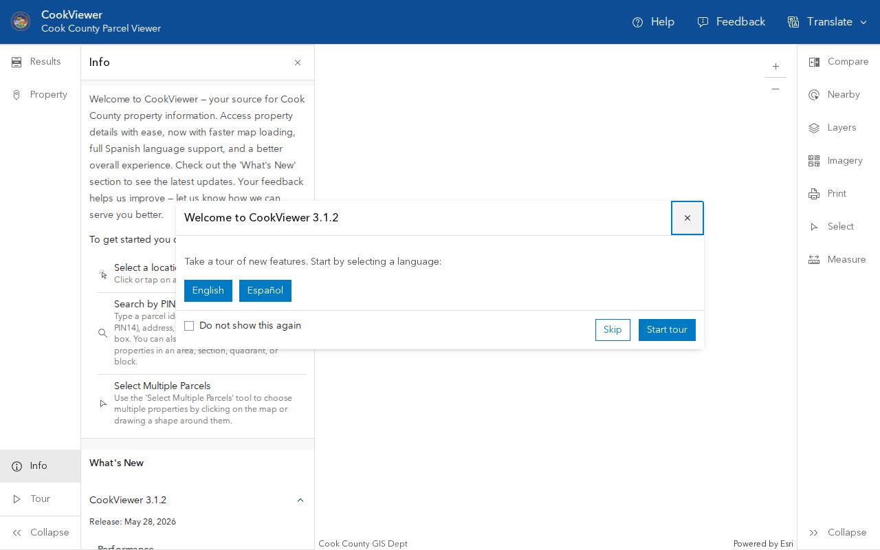
The parcel outline is a location check. It does not name everyone at the property, and map geometry may require confirmation from the Clerk's plat or legal description.
Note: CookViewer release notes show active maintenance, so save the map date when using an image as part of a long-term street history.
Five Blue Island Address Identities
A Blue Island address can have five distinct identities. The postal identity is the USPS delivery city, state, ZIP, and street form. The parcel identity is CookViewer geometry and the PIN. The tax identity includes a tax code and billing address. The legal identity appears in a deed, plat, subdivision, lot, or section-township-range description. A historical identity may come from the 1929 conversion table, a Sanborn sheet, a newspaper, or an old directory.
- Parcel
- A mapped unit of land identified in Cook County by a 14-digit PIN.
- Situs address
- The physical parcel location, which may differ from a tax-bill mailing address.
- Plat
- A recorded map showing lots, blocks, subdivisions, or other legal boundaries.
- Criss-cross directory
- A directory arranged by street and house number rather than only by surname.
This distinction prevents a common error. A tax bill may go to an owner, lender, agent, or another recipient. That mailing field is not evidence that the recipient occupied the Blue Island parcel.
Follow Blue Island Deeds
The Cook County Clerk recording index searches address, PIN, grantor, grantee, document number, and indexed text. A grantor transfers an interest; a grantee receives it. For a street directory question, the PIN is often the cleanest bridge from parcel to deed. Search results should be copied with the document number, recorded date, type, parties, PIN, legal description, address clue, and image or copy status intact.
County material describes the online database as covering 1985 forward, while recorded documents reach back to 1871 through books, acetate, microfilm, offsite originals, and digital media. An absent image is not proof that the document does not exist. Older or restricted-to-counter copies can be requested through the Clerk's Recordings help desk at 118 N Clark Street, Room 120, Chicago, by phone at 312-603-5050, or by email at clerk.recordings@cookcountyil.gov.
The recording-index capture shows the direct search routes used after a Blue Island PIN is found.
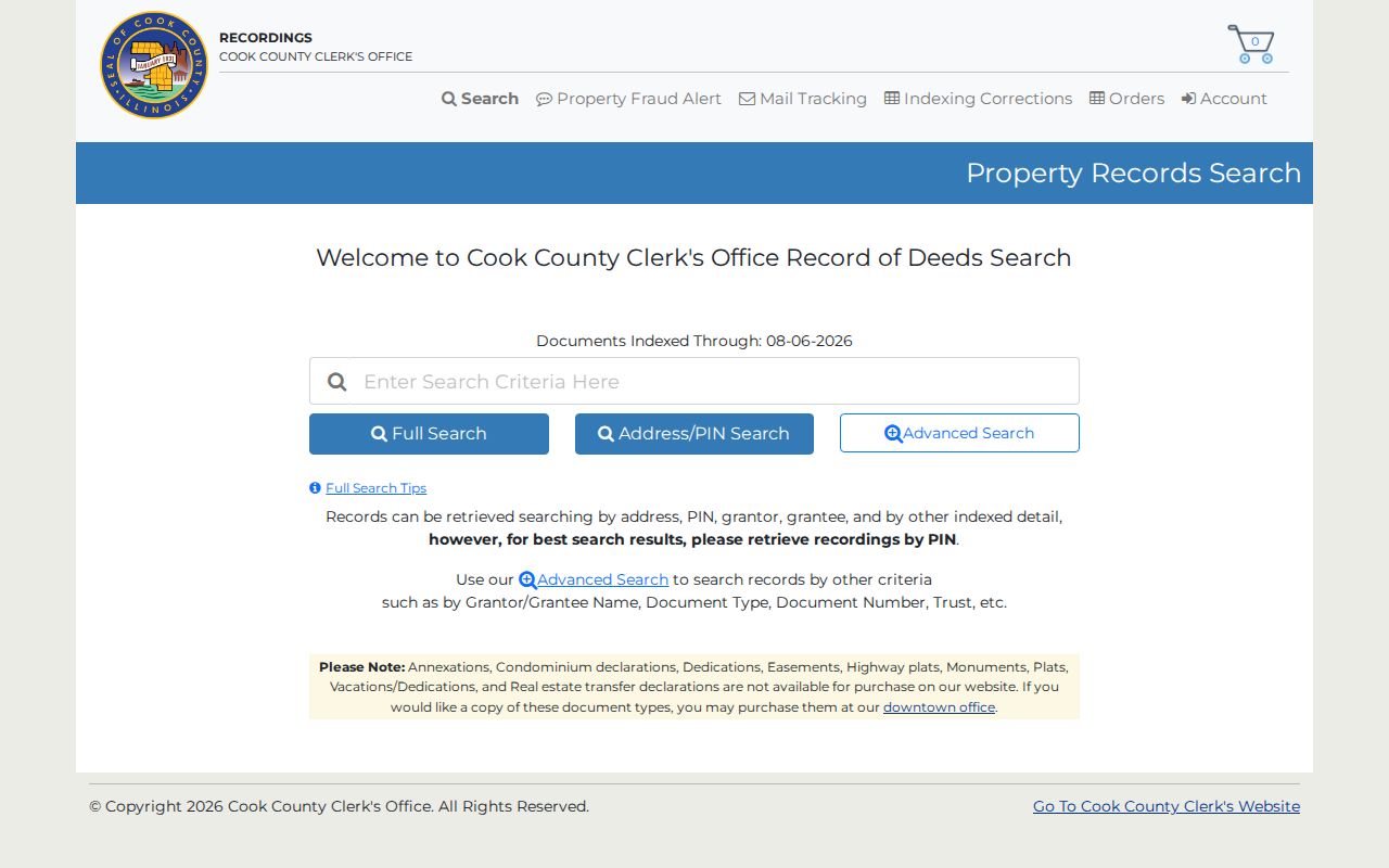
Full Search is useful for a mixed name-and-street query, while Address/PIN and Advanced Search provide tighter control.
Blue Island Records by Street
No single Blue Island street directory contains all owners, occupants, permits, and past households. Each source has its own custodian and access route. The most reliable approach records what each result can actually establish.
| Record Set | Keeper | What It Shows | Access |
|---|---|---|---|
| Property record | Cook County Assessor | Parcel location, PIN, class, values, characteristics, exemptions | Online, phone, or appointment |
| Parcel map | Cook County GIS | Geometry, nearby parcels, address and intersection context | Free CookViewer; GIS email fallback |
| Deeds and liens | Cook County Clerk | Recorded parties, dates, document type, legal description | Free index; paid or counter copies |
| Voter record | Illinois and Cook County elections | A registration match after identity fields | Restricted official workflow |
| Permits and code files | Blue Island Building Safety | Work description, owner or contractor fields when recorded | Office, phone, email, or FOIA; no public address index located |
The PIN joins the parcel, tax, and deed systems. Address wording joins permit and directory research. Illinois voter files have purpose limits and redact fields including date of birth, street number, phone, Social Security number, and identifiable email. The public registration lookup requires a known person's first and last name, birth date, and ZIP before its street step, so it cannot be used as a free-form street roster.
Blue Island Permit Address Trail
Blue Island Building Safety handles permits, zoning, inspection, and code matters. A permit record may carry the site address, R.E. Index Number, type of work, owner, contractor, approvals, and inspections. It is a building event, not a resident list. No public address-keyed permit or code-case portal was located, so the fallback chain matters: contact the department, identify the address and date range, and use an Illinois Freedom of Information Act request when needed.
The Building Safety capture records the city route for those address files.
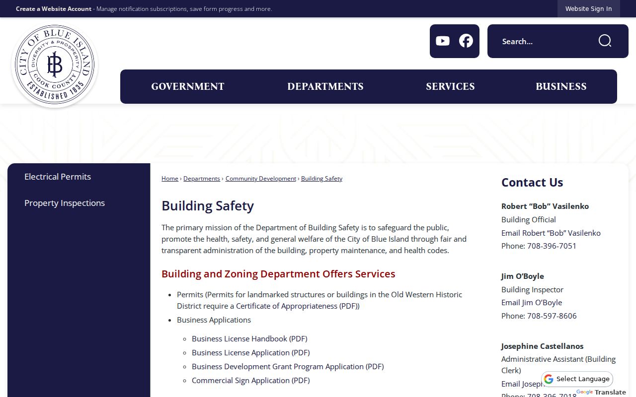
This office route fills a gap left by county ownership systems: it can document work at the place even when it does not establish who lived there.
Translate Blue Island Street Numbers
The Blue Island Historical Society's 1929 address table is a rare bridge between an old directory entry and a modern parcel search. It contains New and Old Name columns plus number conversions. On W 119th Place, for example, old 308 became 2046, old 299 became 2050, and old 298 became 2051. Preserve the exact row because a line may show a number change, a name change, or both.
After conversion, verify the current delivery form through USPS, locate the parcel in CookViewer, and search the PIN in the Assessor and recording index. The table does not identify a person by itself. Sanborn maps, the city comprehensive plan, and Historical Society maps can then supply dated building and district context.
Note: Blue Island's incorporation, annexation, and later boundary changes can shift the government series that holds a record even when the site did not move.
When Blue Island Parcels Change
A split or consolidation can break a simple by-address search. Compare the current PIN with older PINs, the recorded legal description, subdivision and lot data, GIS geometry, plats, and corrected deeds. The Clerk's Advanced Search allows section, township, range, subdivision or condominium name, block number, lot number, and part-of-lot details. Certain plats, dedications, annexations, easements, monuments, and related instruments are not available for online purchase, so downtown copy service may be required.
A local example shows why jurisdiction also matters. Blue Island's 2017 annexation petition for 3415 127th Street described territory outside any municipality, contiguous to Blue Island, and with no electors. That filing connects a legal description to city records, parcel geography, and later jurisdiction. It should not be treated as evidence about current occupants.
Blue Island Street Directory Limits
A parcel owner is not necessarily a resident. A tax-bill recipient is not necessarily an owner or occupant. A deed shows a recorded transfer, not who slept at an address on a given date. No complete public Blue Island renter, household-member, utility-customer, code-case, or permit index was located. Driver address data is restricted, and Illinois voter data carries access, use, and redaction rules.
Use names from a street directory as leads that need a date and a second source. An apparent gap may reflect a changed address, a parcel split, an unlisted household, an older record medium, or a confidential address. Illinois also operates an Address Confidentiality Program for eligible survivors. Public-facing records should never be used to defeat that protection.
Lawful use. Blue Island address records are for lawful personal research, family history, property questions, and civic review. Never use them to stalk, harass, intimidate, or harm anyone.
For a current record not found online, contact the named custodian first. The Assessor offers phone and appointment access; GIS accepts email; the Clerk provides counter, phone, email, mail, and paid-copy routes; the city handles local files and FOIA requests. Historical gaps may require Blue Island Public Library, the Historical Society, Newberry Library, Cook County Archives remote reference, or IRAD.