
Blue Island Neighbor Sources by Block
No public system names every person around a Blue Island address. The useful method is to match each question with the right source. Parcel maps define the lots. Assessment and tax records describe each parcel. Election sources resolve districts under special rules, while civic directories show organizations rather than households.
| Source | What It Shows About a Block | How to Access It |
|---|---|---|
| CookViewer | Parcel outlines, adjacent PINs, mapped street segment, Property Details | Search an address, PIN, or intersection; click parcels; print or export |
| Assessor and Treasurer | Parcel location, traits, tax code, exemptions, and tax mailing field | Search each parcel online; compare fields rather than merging names |
| Illinois voter sources | Personal registration check or a lawful district-by-address file | Identity-based lookup or prescribed application under special limits |
| Chamber directory | Nearby member firms, institutions, and civic groups | Public voluntary membership directory |
| Blue Island–Robbins network | Community network and committee context | Public program pages; no public member roster located |
| BIHS and preservation files | Historic districts, buildings, maps, and place stories | Online collections, city pages, or BIHS appointment |
| City and library resources | Public services and organizations by category | City resource directory and library holdings |
Ownership is not the same as presence. A tax-bill destination may belong to an agent or mortgage firm. An exemption can be consistent with owner occupancy but does not enumerate the household. Shared parcel lines likewise prove only that two pieces of land touch.
Map Blue Island Neighbors by Parcel
CookViewer accepts a full address, street intersection, 10-digit or 14-digit PIN, and dashed PIN. Visible controls include All, Parcel PIN, Parcel Address Locator, Address Locator, Property Details, print, and export. The tool exposes parcel geometry, not a resident layer, and its linework or locator may lag a recent land change.
- Search the seed address or PIN and confirm the parcel outline against the street.
- Record its PIN and open Property Details. Keep the situs or location field apart from any mailing address.
- Click each adjoining parcel shape. Capture the adjacent PIN, displayed address, map scale, and access date.
- Check each PIN in the Assessor and Treasurer systems. Preserve the exact role and date attached to any name.
- Repeat only for parcels that define the immediate block. Use the Blue Island street directory when the task expands to a whole named street.
No dedicated buffer, radius, or “all residents on block” control was found. Condo addresses may return several parcels, so one civic address does not always equal one mapped lot. Work from the geometry that is actually shown.
Read Blue Island Neighbor Parcel Roles
The Assessor record can show the parcel location, PIN, city, township, class, neighborhood, tax code, land area, traits, assessment values, exemption headings, appeal history, and print options. Its own notice says property location is not always the legal or postal mailing address. The Treasurer adds tax and payment history, tax-bill mailing data, recent deed or lien links, and related fields.
Those records help distinguish lots and recorded interests. They do not identify every adult, child, guest, or renter. When a name is shown, label it as owner, grantee, applicant, bill recipient, or other stated role. Never turn an unstated role into an occupant claim. The same caution applies to a permit contractor or code complainant.
- Parcel
- A mapped unit of land identified in Cook County by a PIN.
- Situs
- The location assigned to the parcel, which may differ from a mailing address.
- Adjacent parcel
- A separately identified lot whose mapped boundary touches the seed parcel.
- Tax mailing address
- The destination selected for a tax bill, not proof of where its recipient lives.
Find Blue Island Neighbor Civic Contacts
Community sources add a human layer without promising a roster of Blue Island neighbors. The Chamber member page can identify member organizations, public institutions, and local groups. The city resource directory sorts public services and organizations by category. Each entry should be checked against the organization's own current page.
| Local Resource | Best Use | Roster Limit |
|---|---|---|
| Blue Island Chamber of Commerce | Member firms, institutions, and community groups | Voluntary member directory, not resident data |
| Blue Island–Robbins Neighborhood Network | Committee and neighborhood-work context | No public participant roster located |
| City community resource directory | Local service and organization leads | Category listings require status checks |
| City Council and aldermen | Ward representation, meetings, agendas, and minutes | Ward contacts are not household lists |
| Blue Island Historical Society | Maps, district context, and past block research | Collection access and appointment rules apply |
The network brings community members, leaders, and organizations into committees such as Socio-Emotional Wellness and Healthy Eating Active Living. No official citywide homeowners-association or block-club roster was located, so none should be implied.
The Chamber member directory shows the kind of voluntary organization inventory available locally.

Use these entries to find public group contacts near a block, not to infer where a member lives.
Blue Island Neighbor Wards and Contacts
A city ward or election precinct is a civic boundary, not a parcel neighborhood. Blue Island's aldermen page supplies ward representation, meetings, agendas, minutes, and a ward map. District lines can change, so verify a current address with the official election authority before contacting a representative or citing a district.
The City Council and aldermen page is the source for current municipal contacts.
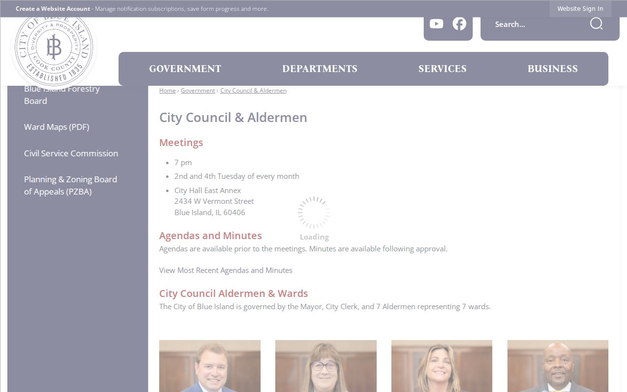
The ward source connects a parcel to civic representation, but it does not say who occupies that parcel.
Illinois Voter Rules for Blue Island Neighbors
The ordinary Illinois voter lookup verifies one person's registration through first name, last name, birth date, five-digit ZIP, and a later street-number and street-name step. It is not a browse-all-block tool. For a district question, Cook County election staff or the State Board's district-by-address route is the proper path.
Illinois law places special limits on voter data. Under 10 ILCS 5/1A-25, copying, transmission, advertising, solicitation, intimidation, deception, and personal, private, or commercial use are restricted. Distributed files may redact street number, birth date, phone, Social Security number, and identifiable email. Ballot choices are not public, and Illinois does not maintain a standing party affiliation in the way some states do.
The Cook County Clerk handles suburban registration and election questions at 312-603-5656. The State voter-data office provides prescribed applications, including a district-by-address route. A broad public-records request is not a substitute for those election rules.
Historic Blue Island Neighbor Blocks
Modern parcel shapes do not tell the whole story. Blue Island's 1929 Revised Street Addresses and Name Changes table can rebuild older block references one row at a time. West 119th Place examples include old 308 becoming 2046, old 299 becoming 2050, and old 298 becoming 2051. The table may change the street name, number, or both.
Historic district and planning maps add other boundaries. The Olde Western business district lens runs along Western Avenue from 119th to 135th, and along Vermont from Division to Greenwood. Sanborn maps describe dated building footprints and uses. None of these sources proves a present household, but together they explain why an old news item or directory entry may appear under a different address.
Official Tools for Blue Island Neighbors
Official sources publish fields for a defined public task. CookViewer maps parcels. The Assessor values property. The Treasurer administers tax records. The Clerk indexes recorded documents, and election agencies apply voter-law limits. Each source provides a custodian, field meanings, and a route to ask about errors.
Official records
Best for parcel keys, dated instruments, ward contacts, and facts tied to a named public office. Gaps, redactions, and access rules remain visible.
Commercial neighbor tools
May blend old licensed and public data without making roles or dates clear. Treat any name as a lead and return to the originating office.
Neither category can prove who is physically present now. The most useful block result is a documented map of parcels, public roles, groups, and civic lines, not a guessed household list.
Privacy Limits for Blue Island Neighbors
Some information remains private by law or was simply not found in the public sources. Utility customer and delivery records are not a public Blue Island neighbor index. Driver data is restricted. Court files can be sealed or expunged, and vital records have identity and relationship rules.
Illinois also runs an Address Confidentiality Program for survivors of domestic violence, sexual assault, stalking, and human trafficking. The program provides a substitute address and mail forwarding. It does not make every earlier public document vanish, so a researcher should never use old address data to defeat a safety measure.
Respect the block. Use Blue Island neighbor records for civic contact, local history, or ordinary personal awareness. Never use them to watch, threaten, shame, or harass anyone.
Check Every Blue Island Neighbor Claim
Record the seed address, PIN, parcel outline, adjoining PINs, search date, and source. For each name, state the role shown and the record date. If a mailing field conflicts with the situs, preserve both. If CookViewer and the Assessor differ, ask Cook County GIS at gis@cookcountyil.gov or the Assessor at 312-443-7550 rather than choosing one silently.
For civic records not online, contact the City Clerk at 708-597-8603 or make a narrow Illinois Freedom of Information Act request for an existing ward map, meeting record, permit index, or other identified item. Library and archive staff can help with historical directories, news, and maps, but their old entries are not current proof about your neighbors.